WW2 1944 RAF Flying Map Northern Europe.
Code: 21330
SOLD
WW2 1944 RAF Flying Map Northern Europe.
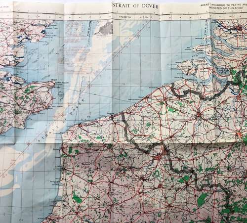
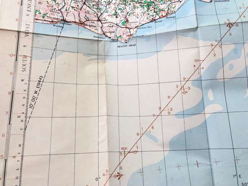
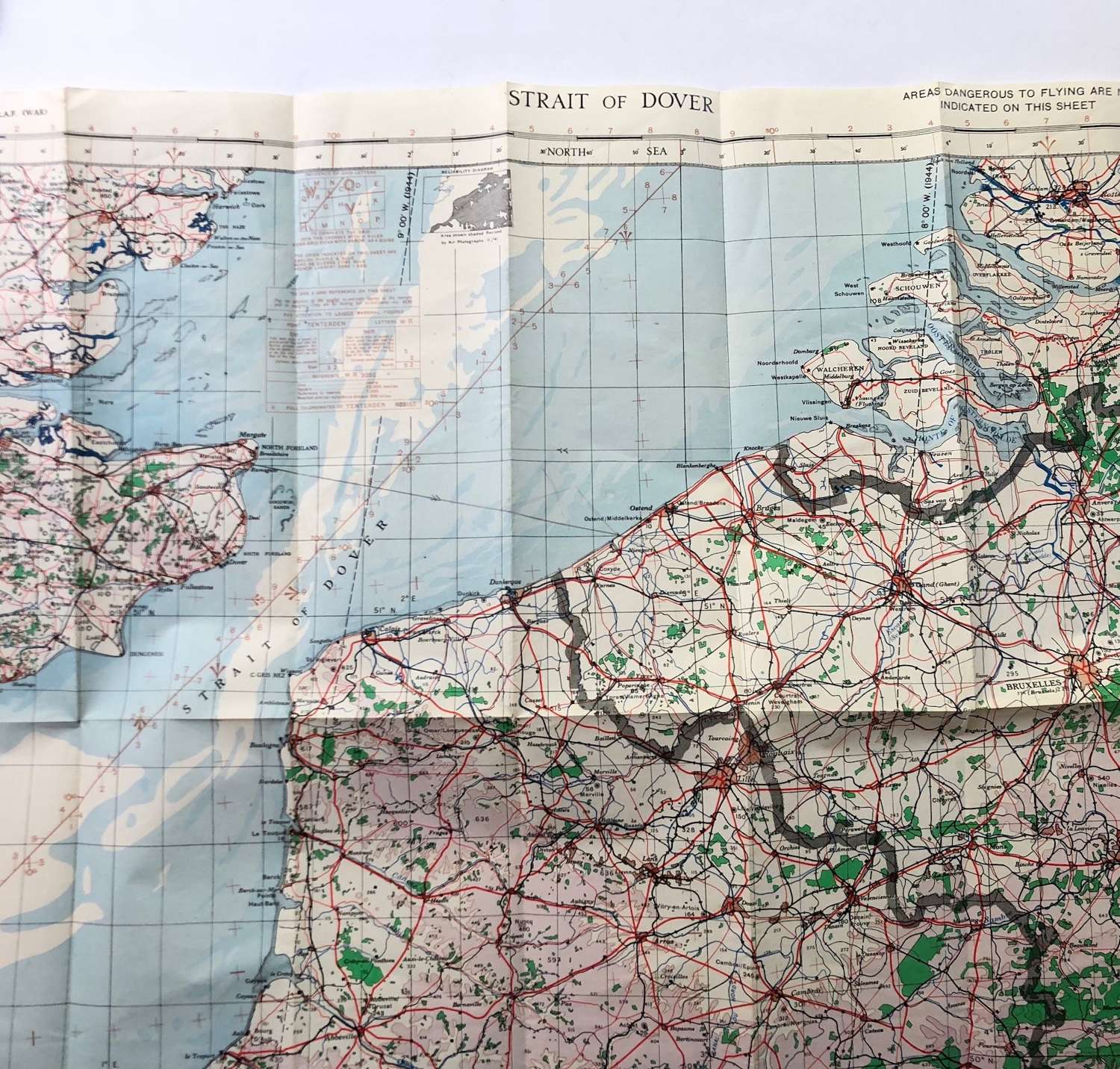
Titled Strait of Dover RAF War Map 1:500,000 printed in 1944. Shows Southern England and Northern Europe. VGC.
Ideal for a D-Day and break out collector