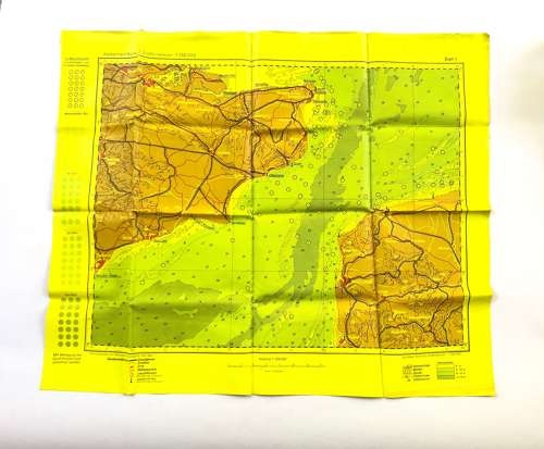
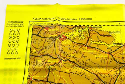
WW2 1943 Luftwaffe Night Flight Map Kent.
Code: 20344
SOLD
WW2 1943 Luftwaffe Night Flight Map Kent.
A superb example of the waterproof yellow coloured map used by Luftwaffe crews night flying. This example shows northern France and Kent. Near unissued condition. A real soldiers bring back example.
Size 25 1/2 x 20 1/2 inches.